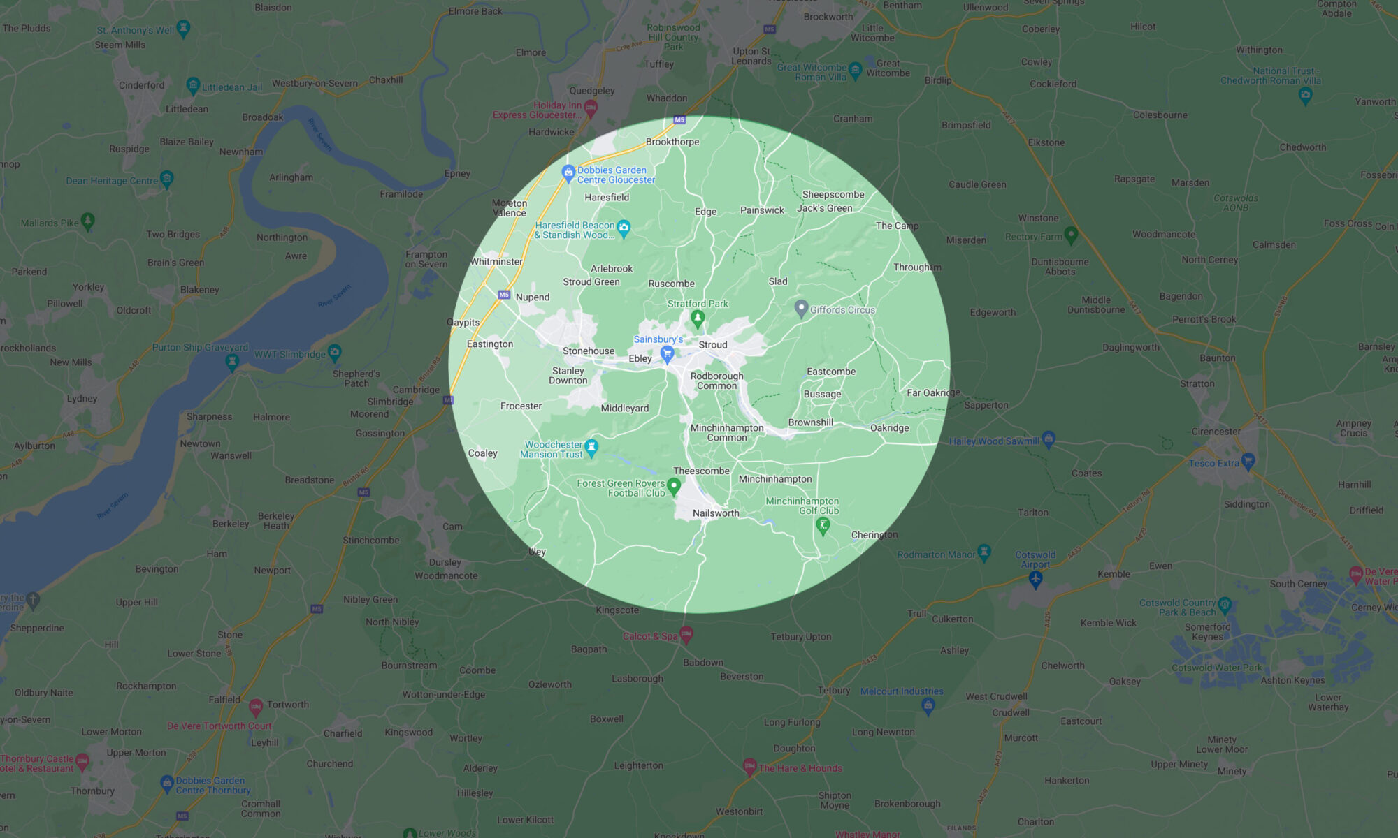
One of the main drivers for this project was the optimistic idea that people might somehow be encouraged to reduce their CO2 emissions by not travelling abroad so often. I don’t know whether that is possible but it seems worth a try. I think sometimes we can be fixated with destinations and forget what it is like to simply explore what’s around us. I want to celebrate the intriguing, the hidden, and the unexpected that can be found on the journey rather than what you find when you arrive. With that in mind, I decided to create a way of picking some random local destinations to walk to. Rather than just sticking a pin in a map, I thought it would be interesting if these destinations would somehow be symbolically (and geometrically) linked to exotic locations we might travel to. Introducing the Destination Localizer.
The basic idea is to pick a destination – say Fiji for example – and work out the distance to there from home (11560 km) and the initial direction you would travel to get there (a bearing of 335°) and then work out where that would be if you scaled (and flattened) the world down to a circle with a 5.36 mile radius. And the answer for Fiji is somewhere between Edge and Brookthorpe. At some point, I hope to create an app that will allow you to plug in the numbers and it will generate the answer. In the meantime, should anyone feel the urge to try this for themselves (no? just me then), here are the steps you need to follow.
Step 1. Pick the radius for your world in miles (5.36 in my case)
Step 2. Get approximate latitude and longitude (in decimal degrees) of my home by entering my postcode in the form at https://www.gps-coordinates.net/
Step 3. Get latitude and longitude (in decimal degrees) of real-world location by entering name in the form at https://www.gps-coordinates.net/
Step 4. Use the Great-circle distance between two points form at http://www.movable-type.co.uk/scripts/latlong.html to calculate distance and initial bearing of destination (lat, long from step 3), given a starting point of my home (lat, long from step 2)
Step 5. Calculate the distance to the mapped local destination by: (distance in Step 4) x (radius from Step 1)/ 12,429.5
Step 6. Use the Destination point given distance and bearing from start point form at http://www.movable-type.co.uk/scripts/latlong.html to calculate a local destination (lat, long) given the starting point of my home (lat, long from step 3), an initial bearing (step 4), and a distance (step 5).
And the results after feeding in 11 global destinations are: